Infrastructure east of Dilton Marsh railway station
Introduction
The photograph on this page of Infrastructure east of Dilton Marsh railway station by Brian Robert Marshall as part of the Geograph project.
The Geograph project started in 2005 with the aim of publishing, organising and preserving representative images for every square kilometre of Great Britain, Ireland and the Isle of Man.

There are currently over 7.5m images from over 14,400 individuals and you can help contribute to the project by visiting https://www.geograph.org.uk
Infrastructure east of Dilton Marsh railway station
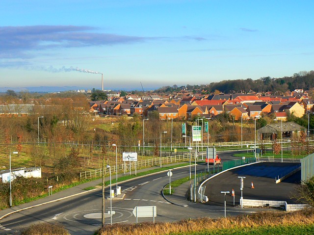
Image: © Brian Robert Marshall Taken: 12 Dec 2007
The mini roundabout in the foreground is in this square as is the area of black tarmac in the right foreground, the site of which would seem to have been cleared since the last Google Earth flyover. The tall chimney on the skyline is that of the Lafarge cement works in ST8852/8952.
Images are licensed for reuse under creativecommons.org/licenses/by-sa/2.0
Image Location
Latitude
51.248718
Longitude
-2.206696