Timber stacks
Introduction
The photograph on this page of Timber stacks by John Winder as part of the Geograph project.
The Geograph project started in 2005 with the aim of publishing, organising and preserving representative images for every square kilometre of Great Britain, Ireland and the Isle of Man.

There are currently over 7.5m images from over 14,400 individuals and you can help contribute to the project by visiting https://www.geograph.org.uk
Timber stacks
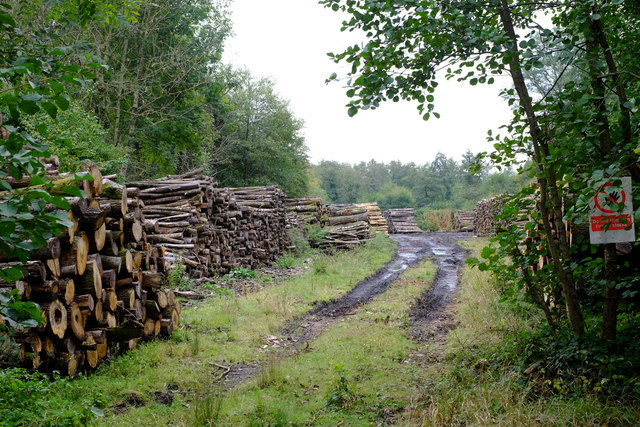
Image: © John Winder Taken: 5 Oct 2019
Actually, there's more to this photo than some stacks of timber. This is the trackbed of the old Severn & Wye Railway which ran from Lydney to Cinderford via Parkend. The history of the line is enormously complicated, as it began as a tramway in about 1810 and was only converted to a "proper" railway because of quite a lot of political wrangling, but it seems that it existed as a standard gauge line by around 1870. The line to Cinderford was never really a success, and closed by 1951: however, this section of line remained open in order to allow trains to access the Coleford branch, which had lost its passenger service (along with the rest of the Severn & Wye system) in 1929 but remained open until 1967 for freight traffic, mostly stone from Whitecliff Quarry. This photo was shot roughly from the site of Coleford Junction looking back towards Parkend.
Images are licensed for reuse under creativecommons.org/licenses/by-sa/2.0
Image Location
Latitude
51.774089
Longitude
-2.563308