Rockface, Primrose Hill
Introduction
The photograph on this page of Rockface, Primrose Hill by Derek Harper as part of the Geograph project.
The Geograph project started in 2005 with the aim of publishing, organising and preserving representative images for every square kilometre of Great Britain, Ireland and the Isle of Man.

There are currently over 7.5m images from over 14,400 individuals and you can help contribute to the project by visiting https://www.geograph.org.uk
Rockface, Primrose Hill
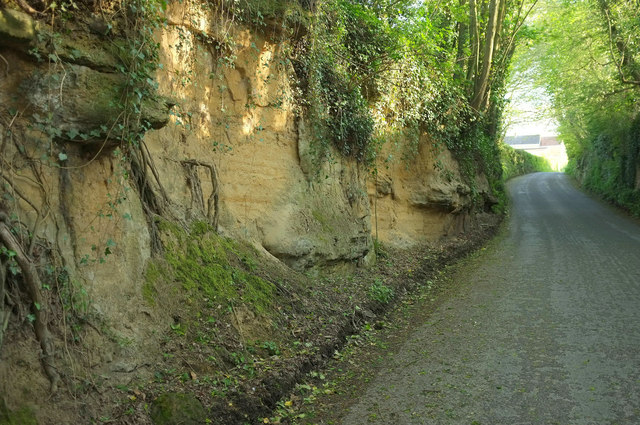
Image: © Derek Harper Taken: 27 Apr 2019
South of Beryl Knapp, the lane becomes a hollow way through the Bridport sandstone. It carries the parish boundary between West Coker (right) and East Coker. An unnamed wood is on the right. The South Somerset Cycle Route RR30 runs here.
Images are licensed for reuse under creativecommons.org/licenses/by-sa/2.0
Image Location
Latitude
50.914253
Longitude
-2.672774