Coal tax boundary post no.53, near Grove Farm Park (detail)
Introduction
The photograph on this page of Coal tax boundary post no.53, near Grove Farm Park (detail) by Mike Quinn as part of the Geograph project.
The Geograph project started in 2005 with the aim of publishing, organising and preserving representative images for every square kilometre of Great Britain, Ireland and the Isle of Man.

There are currently over 7.5m images from over 14,400 individuals and you can help contribute to the project by visiting https://www.geograph.org.uk
Coal tax boundary post no.53, near Grove Farm Park (detail)
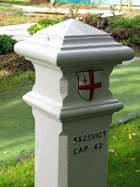
Image: © Mike Quinn Taken: 9 Oct 2019
See Image and Image Here, the remains of two of the screws of the correction plate can be seen, one by the initial "4", and the other immediately below the final "2".
Images are licensed for reuse under creativecommons.org/licenses/by-sa/2.0
Image Location
Latitude
51.61814
Longitude
-0.431485