River Medlock and the Mancunian Way
Introduction
The photograph on this page of River Medlock and the Mancunian Way by Gerald England as part of the Geograph project.
The Geograph project started in 2005 with the aim of publishing, organising and preserving representative images for every square kilometre of Great Britain, Ireland and the Isle of Man.

There are currently over 7.5m images from over 14,400 individuals and you can help contribute to the project by visiting https://www.geograph.org.uk
River Medlock and the Mancunian Way
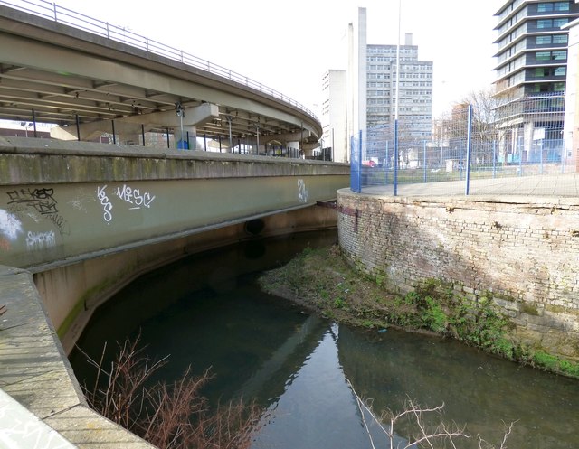
Image: © Gerald England Taken: 21 Feb 2019
On the right is a development called Mill Point. On the left is the Mancunian Way. There is a slight dispute as to whether this section is the A57(M) or the A635(M). In the background are buildings originally part of UMIST now the University of Manchester.
Images are licensed for reuse under creativecommons.org/licenses/by-sa/2.0
Image Location
Latitude
53.474102
Longitude
-2.228512