Western Dawlish
Introduction
The photograph on this page of Western Dawlish by Derek Harper as part of the Geograph project.
The Geograph project started in 2005 with the aim of publishing, organising and preserving representative images for every square kilometre of Great Britain, Ireland and the Isle of Man.

There are currently over 7.5m images from over 14,400 individuals and you can help contribute to the project by visiting https://www.geograph.org.uk
Western Dawlish
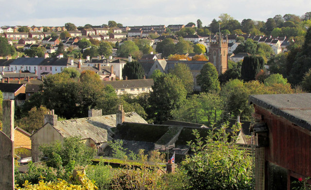
Image: © Derek Harper Taken: 20 Oct 2019
A view from Empsons Hill. The building in a sad state towards the left is also shown at Image It is listed as "13, Weech Road and former gig house" https://historicengland.org.uk/listing/the-list/list-entry/1164525 , "gig" as in "coach". See https://dawlish.com/thread/details/44940 . http://web.archive.org/web/2016*/http://www.teignbridge.gov.uk/media/pdf/a/5/EX2005_June_13_Rep_Weech_Road_Dawlish.pdf has the following "A recent inspection has revealed that the main building and outbuilding still require works to make them wind and weatherproof and prevent collapse. The main building has holes in the roof, dry rot, unsecured open windows and doors and internally has part of the first floor missing. There is running water through the roof and rising and penetrating damp. The unoccupied outbuilding is constructed of cob with slate roof, historic trusses and stable pavers. It is a good example of a simple but historic curtilage building. Sections of the outbuildings cob wall have degraded to an extent that partial collapse is possible." To the right is St Gregory's church, grade II* listed https://historicengland.org.uk/listing/the-list/list-entry/1164203 .
Images are licensed for reuse under creativecommons.org/licenses/by-sa/2.0
Image Location
Latitude
50.581503
Longitude
-3.481596