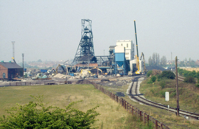
Demolishing Kiveton Park Colliery 1995
Introduction
The photograph on this page of Demolishing Kiveton Park Colliery 1995 by Richard Bird as part of the Geograph project.
The Geograph project started in 2005 with the aim of publishing, organising and preserving representative images for every square kilometre of Great Britain, Ireland and the Isle of Man.
There are currently over 7.5m images from over 14,400 individuals and you can help contribute to the project by visiting https://www.geograph.org.uk

Image: © Richard Bird Taken: 19 Apr 1995
The colliery closed in 1994 and the main shaft buildings were demolished a year later. However, the mine's pithead baths were deemed to be of historical value and had a listed building order placed on them. But they never opened to public view and due to vandalism they were eventually demolished in 2013. The whole site has been landscaped and fishing ponds were added. The Norwood canal tunnel of the Chesterfield Canal passes close beneath and it has been proposed to untop the tunnel here and substitute a flight of locks in its place. But, as yet, nothing has materialised due to local problems and the inevitable cash shortage. In the photograph can be seen the huge electric winding apparatus.

