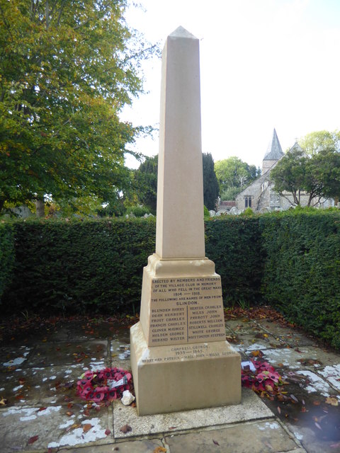
Slindon War Memorial
Introduction
The photograph on this page of Slindon War Memorial by Marathon as part of the Geograph project.
The Geograph project started in 2005 with the aim of publishing, organising and preserving representative images for every square kilometre of Great Britain, Ireland and the Isle of Man.
There are currently over 7.5m images from over 14,400 individuals and you can help contribute to the project by visiting https://www.geograph.org.uk

Image: © Marathon Taken: 19 Oct 2019
Writing in Pevsner's The Buildings of England: Sussex, Ian Nairn describes Slindon "A good flint and brick village on the south slopes of the Downs. Built around a quadrilateral of lanes, with the focus in the north-west corner, above the church, with a tiny handsome open space where three roads meet and a big tree in the middle of it. Quite unspoilt." It doubtless helps that the National Trust owns the Slindon Estate and two thirds of the properties still belong to the estate. This is the war memorial next to the churchyard.

