Jemmett Road
Introduction
The photograph on this page of Jemmett Road by John Baker as part of the Geograph project.
The Geograph project started in 2005 with the aim of publishing, organising and preserving representative images for every square kilometre of Great Britain, Ireland and the Isle of Man.

There are currently over 7.5m images from over 14,400 individuals and you can help contribute to the project by visiting https://www.geograph.org.uk
Jemmett Road
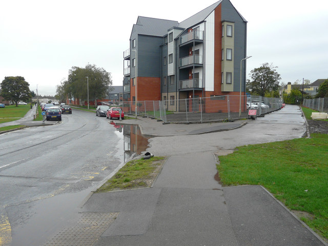
Image: © John Baker Taken: 14 Oct 2019
This was Image in August 2018 when the site, where the apartment block now stands, was hidden by hoarding. The apartment block is part of a development called the Victoria Quarter, where work is still ongoing. Planning permission has been granted by Ashford Borough Council under application number 17/00354/AS for a “reserved matters application for the development of 160 dwellings together with access roads, footpaths, drainage, associated car/bicycle parking provision, ground works, landscaping, open space and infrastructure (pursuant to outline approval 11/00405/AS) “.
Images are licensed for reuse under creativecommons.org/licenses/by-sa/2.0
Image Location
Latitude
51.141411
Longitude
0.861871