Cockermouth History Wall
Introduction
The photograph on this page of Cockermouth History Wall by Jennifer Petrie as part of the Geograph project.
The Geograph project started in 2005 with the aim of publishing, organising and preserving representative images for every square kilometre of Great Britain, Ireland and the Isle of Man.

There are currently over 7.5m images from over 14,400 individuals and you can help contribute to the project by visiting https://www.geograph.org.uk
Cockermouth History Wall
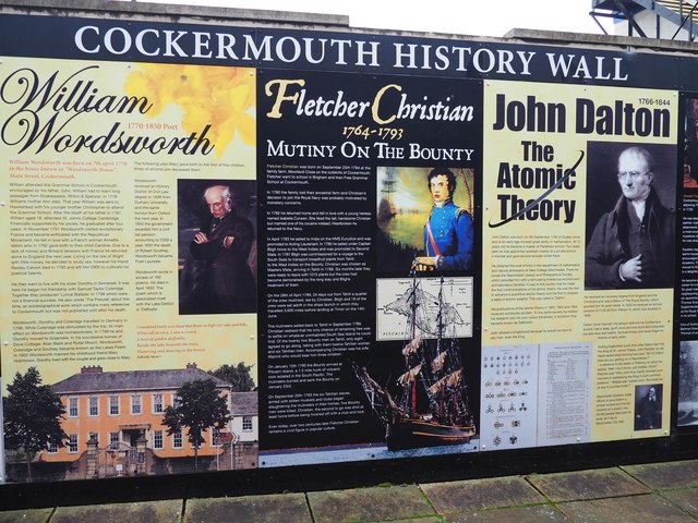
Image: © Jennifer Petrie Taken: 14 Oct 2019
Lots of interesting local history can be read here.
Images are licensed for reuse under creativecommons.org/licenses/by-sa/2.0
Image Location
Latitude
54.664124
Longitude
-3.365359