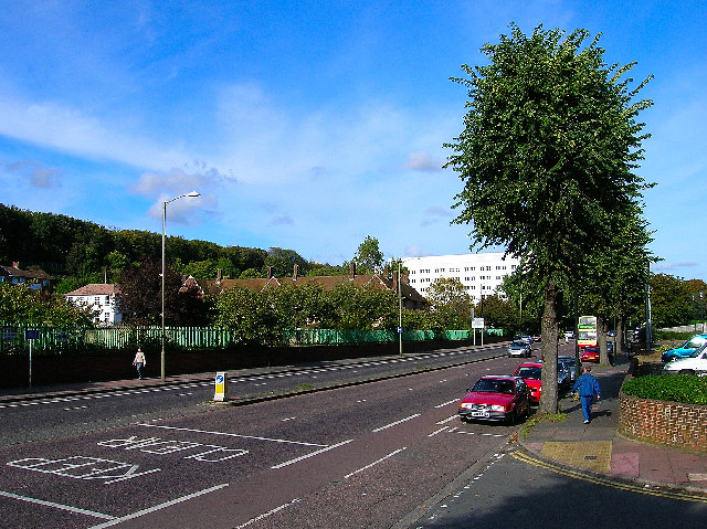
A270 Brighton
Introduction
The photograph on this page of A270 Brighton by Simon Carey as part of the Geograph project.
The Geograph project started in 2005 with the aim of publishing, organising and preserving representative images for every square kilometre of Great Britain, Ireland and the Isle of Man.
There are currently over 7.5m images from over 14,400 individuals and you can help contribute to the project by visiting https://www.geograph.org.uk

Image: © Simon Carey Taken: 9 Oct 2005
Looking north on the former A27 heading out of Brighton on the road to Lewes. The roof of the former Preston Barracks can be seen behind the trees. The barracks once owned extensive tracts of land in the area but have been sold off to become DIY superstores. The last remaining building is now for sale for major redevelopment leaving the white building to the left as the sole building associated with the military. It was given the name Preston Barracks due to it being in the parish rather than the vicinity of the village. The white building behind the former barracks is part of the University of Brighton.
Image Location


