Former Darton Sunday School
Introduction
The photograph on this page of Former Darton Sunday School by Stephen Craven as part of the Geograph project.
The Geograph project started in 2005 with the aim of publishing, organising and preserving representative images for every square kilometre of Great Britain, Ireland and the Isle of Man.

There are currently over 7.5m images from over 14,400 individuals and you can help contribute to the project by visiting https://www.geograph.org.uk
Former Darton Sunday School
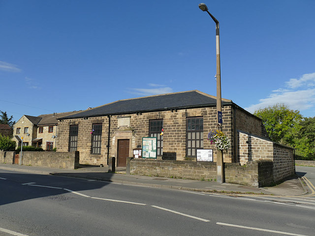
Image: © Stephen Craven Taken: 17 Oct 2019
There is a date of 1818 (in Roman numerals) above the door. It looks to be used as some kind of community hall. Listed grade II (list entry 1314719).
Images are licensed for reuse under creativecommons.org/licenses/by-sa/2.0
Image Location
Latitude
53.586116
Longitude
-1.530927