The former CofE school, St Luke's Road, Ironbridge
Introduction
The photograph on this page of The former CofE school, St Luke's Road, Ironbridge by Richard Law as part of the Geograph project.
The Geograph project started in 2005 with the aim of publishing, organising and preserving representative images for every square kilometre of Great Britain, Ireland and the Isle of Man.

There are currently over 7.5m images from over 14,400 individuals and you can help contribute to the project by visiting https://www.geograph.org.uk
The former CofE school, St Luke's Road, Ironbridge
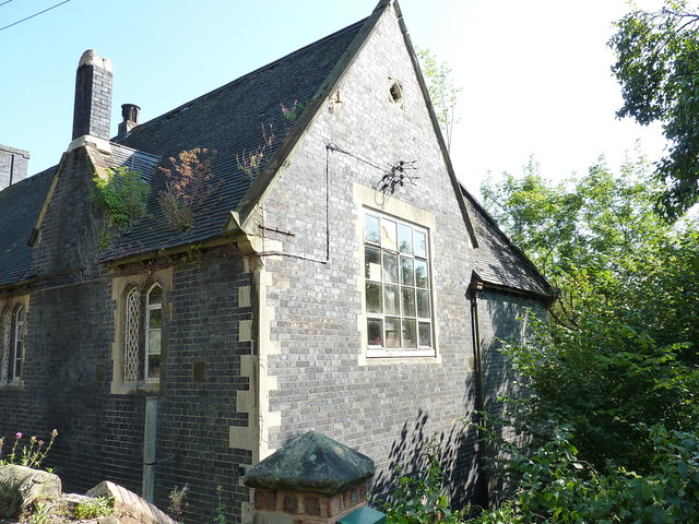
Image: © Richard Law Taken: 26 Aug 2019
Built in the late 1850s, and originally constructed for use as a Church of England School for the town. It appears to be unused at present, but has a Grade II listing https://britishlistedbuildings.co.uk/101038661-church-of-england-school-the-gorge#.XasaIehKjIU & https://historicengland.org.uk/listing/the-list/list-entry/1038661 which was granted in 1974.
Images are licensed for reuse under creativecommons.org/licenses/by-sa/2.0
Image Location
Latitude
52.628364
Longitude
-2.482324