Park View
Introduction
The photograph on this page of Park View by Ian Capper as part of the Geograph project.
The Geograph project started in 2005 with the aim of publishing, organising and preserving representative images for every square kilometre of Great Britain, Ireland and the Isle of Man.

There are currently over 7.5m images from over 14,400 individuals and you can help contribute to the project by visiting https://www.geograph.org.uk
Park View
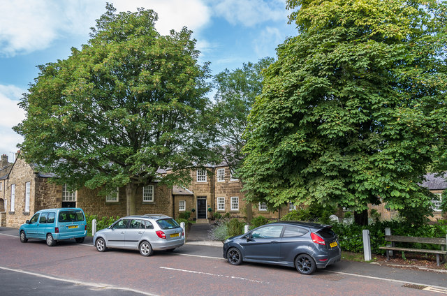
Image: © Ian Capper Taken: 19 Aug 2019
Housing development off Wagonway Road. The building in this photo is a conversion of the former workhouse, later the local council offices. Dating from 1841, it is grade II listed - see www.historicengland.org.uk/listing/the-list/list-entry/1302312.
Images are licensed for reuse under creativecommons.org/licenses/by-sa/2.0
Image Location
Latitude
55.40942
Longitude
-1.700686