Capel Bethel, Rhydargaeau / Bethel Chapel, Rhydargaeau
Introduction
The photograph on this page of Capel Bethel, Rhydargaeau / Bethel Chapel, Rhydargaeau by Alan Richards as part of the Geograph project.
The Geograph project started in 2005 with the aim of publishing, organising and preserving representative images for every square kilometre of Great Britain, Ireland and the Isle of Man.

There are currently over 7.5m images from over 14,400 individuals and you can help contribute to the project by visiting https://www.geograph.org.uk
Capel Bethel, Rhydargaeau / Bethel Chapel, Rhydargaeau
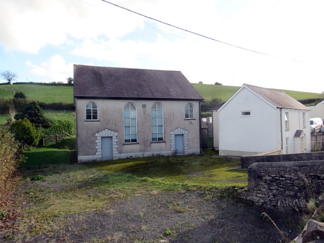
Image: © Alan Richards Taken: 16 Oct 2019
Capel Bethel, addoldy'r Methodistiaid. Codwyd y capel cyntaf yn 1816 ac fe'i hailadeiladwyd yn 1852. Yn ol ei olwg mae e wedi cied. Bethel Methodist Chapel was first built in 1816. The present meeting house was built in 1852. From its appearance it seems to have closed.
Images are licensed for reuse under creativecommons.org/licenses/by-sa/2.0
Image Location


Leaflet Map data © OpenStreetMap
Latitude
51.912732
Longitude
-4.27207