Broad Marsh Redevelopment
Introduction
The photograph on this page of Broad Marsh Redevelopment by Stephen McKay as part of the Geograph project.
The Geograph project started in 2005 with the aim of publishing, organising and preserving representative images for every square kilometre of Great Britain, Ireland and the Isle of Man.

There are currently over 7.5m images from over 14,400 individuals and you can help contribute to the project by visiting https://www.geograph.org.uk
Broad Marsh Redevelopment
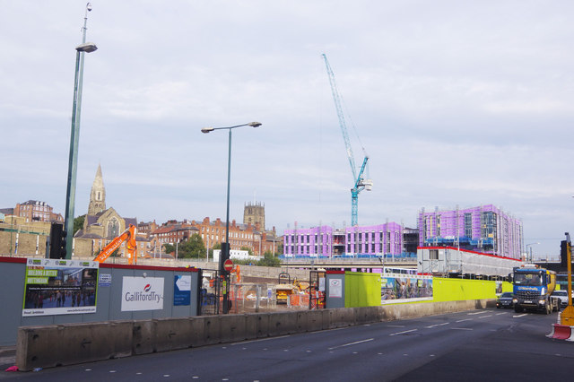
Image: © Stephen McKay Taken: 3 Oct 2019
The huge space here between Canal Street and Collin Street was previously occupied by a bus station and multi-storey car park dating from the mid-1970s. Few people will be sorry to see the building go. The new plans also incorporate a bus station and car park but will hopefully be more aesthetically pleasing. In the distance is the tower of St Mary's Church.
Images are licensed for reuse under creativecommons.org/licenses/by-sa/2.0
Image Location
Latitude
52.949014
Longitude
-1.147609