Parish Room, Mountsorrel
Introduction
The photograph on this page of Parish Room, Mountsorrel by Richard Law as part of the Geograph project.
The Geograph project started in 2005 with the aim of publishing, organising and preserving representative images for every square kilometre of Great Britain, Ireland and the Isle of Man.

There are currently over 7.5m images from over 14,400 individuals and you can help contribute to the project by visiting https://www.geograph.org.uk
Parish Room, Mountsorrel
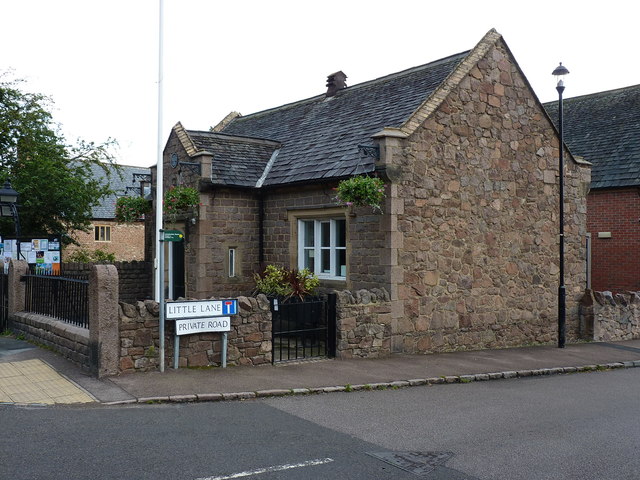
Image: © Richard Law Taken: 14 Aug 2019
By the looks of it now a small council office, this was formerly the Parish Room and an Infant School, Dated 1847, it was Grade II listed https://britishlistedbuildings.co.uk/101228108-parish-room-with-walls-piers-gates-and-railings-mountsorrel#.XZrciEZKhPY & https://historicengland.org.uk/listing/the-list/list-entry/1228108 in 1984, along with the low walls, gates and railings.
Images are licensed for reuse under creativecommons.org/licenses/by-sa/2.0
Image Location
Latitude
52.72933
Longitude
-1.138422