Folkingham from Greenfields Lane
Introduction
The photograph on this page of Folkingham from Greenfields Lane by Kate Jewell as part of the Geograph project.
The Geograph project started in 2005 with the aim of publishing, organising and preserving representative images for every square kilometre of Great Britain, Ireland and the Isle of Man.

There are currently over 7.5m images from over 14,400 individuals and you can help contribute to the project by visiting https://www.geograph.org.uk
Folkingham from Greenfields Lane
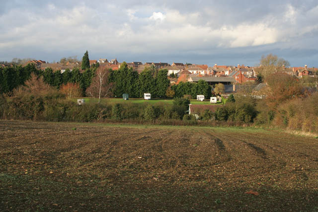
Image: © Kate Jewell Taken: 5 Dec 2007
This shows the west side of Folkingham and the houses on West Street, Churchfields Road and Wilkie Drive. Low Farm Touring Park, a quiet caravan park off Spring Lane is in the valley bottom in the centre of the photograph. The older part of the village is in Image
Images are licensed for reuse under creativecommons.org/licenses/by-sa/2.0
Image Location
Latitude
52.887255
Longitude
-0.412228