Launceston from Saint Stephens Hill 1973
Introduction
The photograph on this page of Launceston from Saint Stephens Hill 1973 by Crispin Purdye as part of the Geograph project.
The Geograph project started in 2005 with the aim of publishing, organising and preserving representative images for every square kilometre of Great Britain, Ireland and the Isle of Man.

There are currently over 7.5m images from over 14,400 individuals and you can help contribute to the project by visiting https://www.geograph.org.uk
Launceston from Saint Stephens Hill 1973
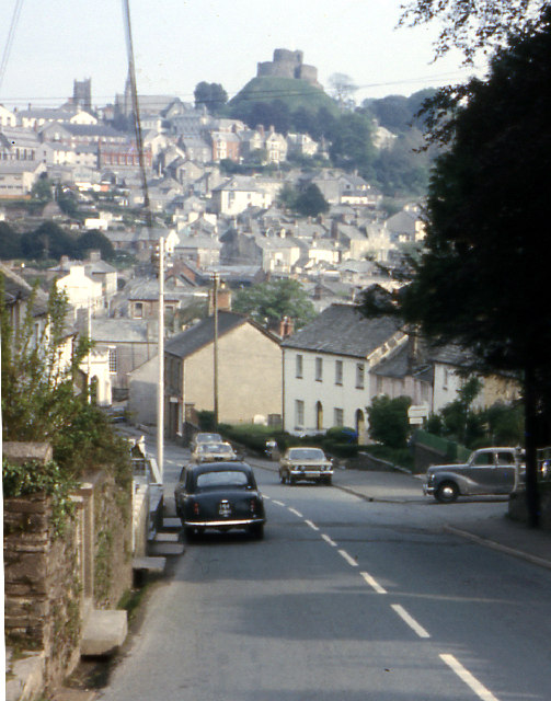
Image: © Crispin Purdye Taken: Unknown
Taken from about half way up Saint Stephens Hill. Original on Boots colourslide film using Agfa Silette 35mm camera
Images are licensed for reuse under creativecommons.org/licenses/by-sa/2.0
Image Location


Leaflet Map data © OpenStreetMap
Latitude
50.644179
Longitude
-4.36901