Former Gourock Ropeworks Building
Introduction
The photograph on this page of Former Gourock Ropeworks Building by Thomas Nugent as part of the Geograph project.
The Geograph project started in 2005 with the aim of publishing, organising and preserving representative images for every square kilometre of Great Britain, Ireland and the Isle of Man.

There are currently over 7.5m images from over 14,400 individuals and you can help contribute to the project by visiting https://www.geograph.org.uk
Former Gourock Ropeworks Building
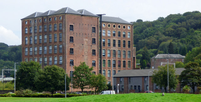
Image: © Thomas Nugent Taken: 24 Aug 2019
Built in the 1860s as a sugarhouse, later converted to a ropeworks, now converted to loft apartments after many years of dereliction. A Category A Listed building http://portal.historicenvironment.scot/designation/LB40067 . Viewed across Coronation Park.
Images are licensed for reuse under creativecommons.org/licenses/by-sa/2.0
Image Location


Leaflet Map data © OpenStreetMap
Latitude
55.933771
Longitude
-4.682157