Hangar 16U
Introduction
The photograph on this page of Hangar 16U by Neil Owen as part of the Geograph project.
The Geograph project started in 2005 with the aim of publishing, organising and preserving representative images for every square kilometre of Great Britain, Ireland and the Isle of Man.

There are currently over 7.5m images from over 14,400 individuals and you can help contribute to the project by visiting https://www.geograph.org.uk
Hangar 16U
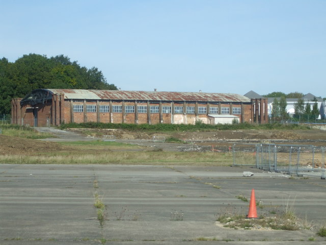
Image: © Neil Owen Taken: 14 Sep 2019
Filton airfield began operating from 1910. With the advent of the Great War, the site became a hotbed for the embryonic armed forces and this hangar was built in 1917. It is known as 16U, a Belfast type with characteristic wooden latticework prepared in Belfast and shipped over. This system of building was a response to the shortages imposed at the time but became a familiar sight on many British airfields. The hangar was used as a service area for the Royal Flying Corps. It became home to operational R.A.F. aircraft from 1929. During WWII it hosted a number of squadrons, notably 501 - Bristol's pride, the County of Gloucester. Understandably, the whole area of aircraft and manufacturing industries was attacked several times. Fast forward to 2019: the whole airfield is closed to flying and is due to be transformed into what is, in effect, a new town of approximately 10,000 inhabitants. The runway, all 2.5km (8,094 ft) of it, is being ripped up but the old Grade II hangar will remain. It will have a completely new interior that offers a variety of leisure and commercial uses.
Images are licensed for reuse under creativecommons.org/licenses/by-sa/2.0
Image Location
Latitude
51.521148
Longitude
-2.584682