Mineshaft and waste lagoon
Introduction
The photograph on this page of Mineshaft and waste lagoon by Jonathan Wilkins as part of the Geograph project.
The Geograph project started in 2005 with the aim of publishing, organising and preserving representative images for every square kilometre of Great Britain, Ireland and the Isle of Man.

There are currently over 7.5m images from over 14,400 individuals and you can help contribute to the project by visiting https://www.geograph.org.uk
Mineshaft and waste lagoon
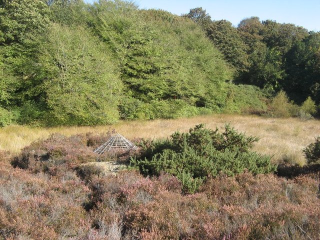
Image: © Jonathan Wilkins Taken: 20 Sep 2019
Marked on the map as an air shaft, this is now covered by a "Clwyd cap" (named after its inventor, apparently) which makes the area safe but allows ventilation and the passage of bats. The flat area at the foot of the valley comprises ancient settling ponds which were known to contain fine, residual ores and would eventually be re-processed. The luxuriant growth of trees by the river is an entirely modern feature, since the area was entirely occupied by the industry, either as mines, dumps, ponds or works for arsenic and ochre. The acidic ground is home to characteristic heather and gorse.
Images are licensed for reuse under creativecommons.org/licenses/by-sa/2.0
Image Location
Latitude
50.238047
Longitude
-5.14657