Ruin of the Fowey blockhouse, seen from the Polruan blockhouse
Introduction
The photograph on this page of Ruin of the Fowey blockhouse, seen from the Polruan blockhouse by Nigel Wassell as part of the Geograph project.
The Geograph project started in 2005 with the aim of publishing, organising and preserving representative images for every square kilometre of Great Britain, Ireland and the Isle of Man.

There are currently over 7.5m images from over 14,400 individuals and you can help contribute to the project by visiting https://www.geograph.org.uk
Ruin of the Fowey blockhouse, seen from the Polruan blockhouse
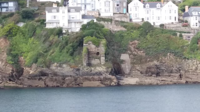
Image: © Nigel Wassell Taken: 17 Sep 2019
Blockhouses were primitive coastal defence mechanisms, used primarily against pirates and other sea raiders in the Middle Ages. A chain was stretched between two towers, one on each side of a river or estuary and raised or lowered as necessary to block or permit passage along the river. The pair of blockhouses at Fowey and Polruan were intended to guard the estuary of the River Fowey. The Western or Fowey blockhouse, seen here, is but a shell, but the eastern or Polruan blockhouse, from which the picture was taken, is in a much better state of preservation.
Images are licensed for reuse under creativecommons.org/licenses/by-sa/2.0
Image Location
Latitude
50.331502
Longitude
-4.64149