Railway Terrace
Introduction
The photograph on this page of Railway Terrace by Jonathan Wilkins as part of the Geograph project.
The Geograph project started in 2005 with the aim of publishing, organising and preserving representative images for every square kilometre of Great Britain, Ireland and the Isle of Man.

There are currently over 7.5m images from over 14,400 individuals and you can help contribute to the project by visiting https://www.geograph.org.uk
Railway Terrace
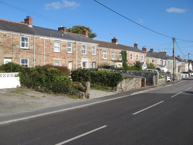
Image: © Jonathan Wilkins Taken: 20 Sep 2019
The functional, stone-built terraced houses of the district are very pleasing. Although marked on a road sign, the name Railway Terrace does not appear on maps. The railway in question crossed the road to Scorrier at exactly this point, being the Redruth & Chacewater Railway of antiquity and fame. Both the terrace and the eponymous railway were extant at the time of the 1877-9 Ordnance Survey of the district.
Images are licensed for reuse under creativecommons.org/licenses/by-sa/2.0
Image Location
Latitude
50.23016
Longitude
-5.181811