WWII airfield bombing decoy control bunker - Moors Valley Golf Course - Update (3)
Introduction
The photograph on this page of WWII airfield bombing decoy control bunker - Moors Valley Golf Course - Update (3) by Mike Searle as part of the Geograph project.
The Geograph project started in 2005 with the aim of publishing, organising and preserving representative images for every square kilometre of Great Britain, Ireland and the Isle of Man.

There are currently over 7.5m images from over 14,400 individuals and you can help contribute to the project by visiting https://www.geograph.org.uk
WWII airfield bombing decoy control bunker - Moors Valley Golf Course - Update (3)
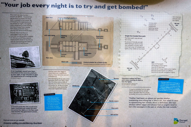
Image: © Mike Searle Taken: 18 Sep 2019
The interpretation display board mounted outside the entrance to the bunker. Click on "More sizes" to download/view a higher resolution copy if required. Image
Images are licensed for reuse under creativecommons.org/licenses/by-sa/2.0
Image Location


Leaflet Map data © OpenStreetMap
Latitude
50.862638
Longitude
-1.85776