Vicar Lane, Howden
Introduction
The photograph on this page of Vicar Lane, Howden by Stephen McKay as part of the Geograph project.
The Geograph project started in 2005 with the aim of publishing, organising and preserving representative images for every square kilometre of Great Britain, Ireland and the Isle of Man.

There are currently over 7.5m images from over 14,400 individuals and you can help contribute to the project by visiting https://www.geograph.org.uk
Vicar Lane, Howden
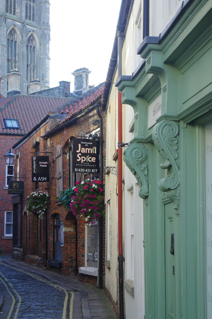
Image: © Stephen McKay Taken: 20 Sep 2019
Immediately to the north of Howden Minster is an area of narrow streets and alleys including Vicar Lane. The tower of the minster overlooks the scene. It is believed that the area may have been an infilling of a large early medieval market place where permanent shops replaced moveable stalls. Several businesses can be seen in this view including Jamil Spice and Peel & Ash, both restaurants.
Images are licensed for reuse under creativecommons.org/licenses/by-sa/2.0
Image Location
Latitude
53.745713
Longitude
-0.866663