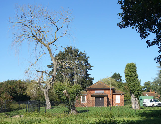
Hughenden Valley Pumping Station
Introduction
The photograph on this page of Hughenden Valley Pumping Station by Des Blenkinsopp as part of the Geograph project.
The Geograph project started in 2005 with the aim of publishing, organising and preserving representative images for every square kilometre of Great Britain, Ireland and the Isle of Man.
There are currently over 7.5m images from over 14,400 individuals and you can help contribute to the project by visiting https://www.geograph.org.uk

Image: © Des Blenkinsopp Taken: 18 Sep 2019
Located at the source of the Hughenden Stream, a chalk stream which now only flows on the rare occasions when the water table is high enough. The balance between river flow and groundwater abstraction is a problem over much of southern England. One effect of this may be the dead tree. Only two years ago it was a beautiful willow, as seen here Image but we have had some dry summers since then.

