Bow Roundabout Vicinity, London E3
Introduction
The photograph on this page of Bow Roundabout Vicinity, London E3 by David Hallam-Jones as part of the Geograph project.
The Geograph project started in 2005 with the aim of publishing, organising and preserving representative images for every square kilometre of Great Britain, Ireland and the Isle of Man.

There are currently over 7.5m images from over 14,400 individuals and you can help contribute to the project by visiting https://www.geograph.org.uk
Bow Roundabout Vicinity, London E3
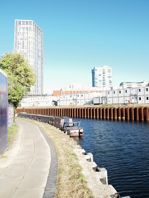
Image: © David Hallam-Jones Taken: 21 Sep 2019
A service road that branches off the Blackwell Tunnel Northern Approach Road - 200 metres from its junction with the "Bow Roundabout" - carries walkers and cyclists down to this towpath. Whilst a 10 minute stroll behind the photographer brings users to Bow Creek and Three Mill Island, ahead are residential developments on Sugar House Island. Hoardings on this side of the River Lea (a.k.a. Lee) mark the boundary with an empty site once occupied by the former Lloyds Paper Mill, the opposite river bank has been reinforced prior to the creation of a new concrete quayside. The skyscraper building in the distance is Sky View Tower, a 30 floor high apartment block on High Street, Stratford, E13.
Images are licensed for reuse under creativecommons.org/licenses/by-sa/2.0
Image Location
Latitude
51.529217
Longitude
-0.010973