Boundary stone with benchmark on SE side of B6264
Introduction
The photograph on this page of Boundary stone with benchmark on SE side of B6264 by Roger Templeman as part of the Geograph project.
The Geograph project started in 2005 with the aim of publishing, organising and preserving representative images for every square kilometre of Great Britain, Ireland and the Isle of Man.

There are currently over 7.5m images from over 14,400 individuals and you can help contribute to the project by visiting https://www.geograph.org.uk
Boundary stone with benchmark on SE side of B6264
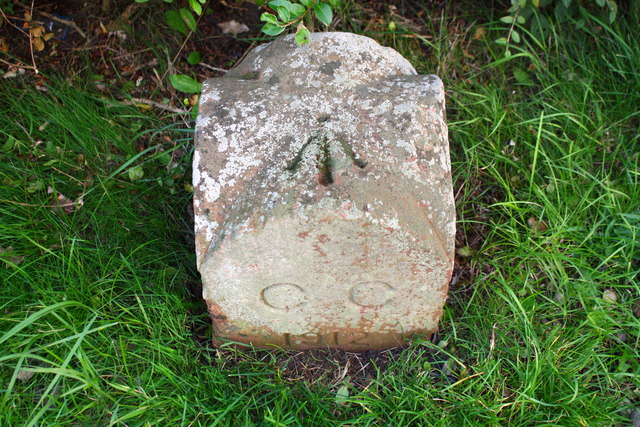
Image: © Roger Templeman Taken: 16 Sep 2019
Ordnance Survey pivot benchmark levelled at 21.497m above Newlyn Datum. There is a 1912 date at the base of the stone
Images are licensed for reuse under creativecommons.org/licenses/by-sa/2.0
Image Location


Leaflet Map data © OpenStreetMap
Latitude
54.910778
Longitude
-2.921803