Queenborough Guild hall
Introduction
The photograph on this page of Queenborough Guild hall by Richard Rogerson as part of the Geograph project.
The Geograph project started in 2005 with the aim of publishing, organising and preserving representative images for every square kilometre of Great Britain, Ireland and the Isle of Man.

There are currently over 7.5m images from over 14,400 individuals and you can help contribute to the project by visiting https://www.geograph.org.uk
Queenborough Guild hall
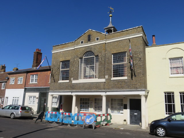
Image: © Richard Rogerson Taken: 17 Sep 2019
The Guild hall built in 1793 and replaced the original one that stood in the middle of the High Street. It contains a museum which tells the story of the town - the name originates from Edward III wife, Queen Phillippa. On Edward III’s orders a Castle was built (1360 -1368) on ground overlooking the Swale so that it commanded the old shipping route from the cost into the Thames. The king gave the castle to his wife,– hence the name of Queenborough.
Images are licensed for reuse under creativecommons.org/licenses/by-sa/2.0
Image Location
Latitude
51.417158
Longitude
0.742278