Dawnay House - Puddletown
Introduction
The photograph on this page of Dawnay House - Puddletown by Mike Searle as part of the Geograph project.
The Geograph project started in 2005 with the aim of publishing, organising and preserving representative images for every square kilometre of Great Britain, Ireland and the Isle of Man.

There are currently over 7.5m images from over 14,400 individuals and you can help contribute to the project by visiting https://www.geograph.org.uk
Dawnay House - Puddletown
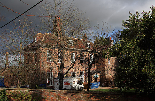
Image: © Mike Searle Taken: 3 Dec 2007
A view from the churchyard of what was the west wing of The Old Vicarage that was added to the older building in 1722. The older part (seen just behind the west wing) originally of circa 1600, was significantly altered probably in the C18 and early C19. The whole now forms two separate semi-detached properties, the west wing being Dawnay House, built for Dr. Henry Dawnay, who was vicar at Puddletown from 1722 to 1754. Grade II* Listed.
Images are licensed for reuse under creativecommons.org/licenses/by-sa/2.0
Image Location


Leaflet Map data © OpenStreetMap
Latitude
50.748875
Longitude
-2.343536