Information board at Sutton Valence Castle
Introduction
The photograph on this page of Information board at Sutton Valence Castle by Marathon as part of the Geograph project.
The Geograph project started in 2005 with the aim of publishing, organising and preserving representative images for every square kilometre of Great Britain, Ireland and the Isle of Man.

There are currently over 7.5m images from over 14,400 individuals and you can help contribute to the project by visiting https://www.geograph.org.uk
Information board at Sutton Valence Castle
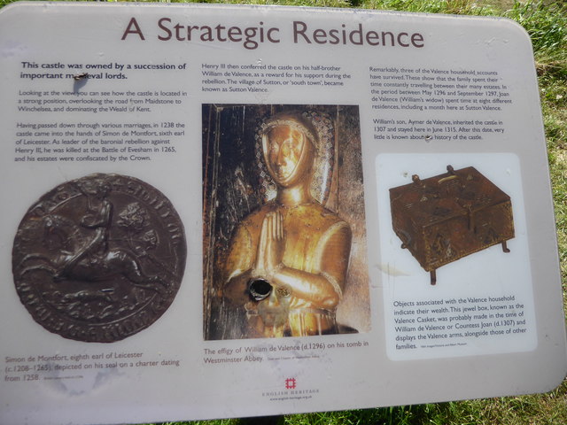
Image: © Marathon Taken: 15 Sep 2019
Sutton Valence Castle was probably built by the Count of Aumale, Baldwin de Bethune in the middle of the 12th century and was used as a residence for over 150 years. In 1238 it came to Simon de Montfort, Earl of Leicester and leader of the baronial rebellion against Henry III. He was killed at the Battle of Evesham in 1265 and his estates were confiscated by the Crown. Henry III then conferred the castle on his half-brother William de Valence as a reward for his support during the rebellion, and the village of Sutton, or 'South Town, became known as Sutton Valence. The castle occupies a strong position on the Greensand Ridge overlooking the Maidstone to Winchelsea road and the Kentish Weald - see https://www.geograph.org.uk/photo/6267350 The castle occupied a much larger area than today. The main survival is the Great Tower the edge of which is seen here. This was built about 1200 and was at least three storeys high. The ground floor was probably used as a storeroom, and external stone stairs led to the main entrance on the first floor. The first floor room was probably for public business, with withdrawing chambers and storage space for treasures and documents in the chambers above it.
Images are licensed for reuse under creativecommons.org/licenses/by-sa/2.0
Image Location
Latitude
51.212431
Longitude
0.597493