The approach to Haxey
Introduction
The photograph on this page of The approach to Haxey by Marathon as part of the Geograph project.
The Geograph project started in 2005 with the aim of publishing, organising and preserving representative images for every square kilometre of Great Britain, Ireland and the Isle of Man.

There are currently over 7.5m images from over 14,400 individuals and you can help contribute to the project by visiting https://www.geograph.org.uk
The approach to Haxey
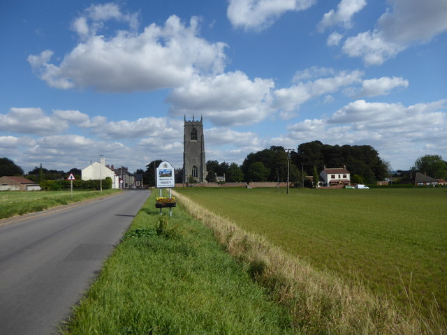
Image: © Marathon Taken: 8 Sep 2019
Batsford's Lincolnshire says: "Haxey is in many ways typical of the Isle of Axholme. It is a large and somewhat straggling settlement. brick-built with a few earlier houses interspersed with the predominant Victorian, and with its outlying hamlets of Graiselound and Westwoodside. From below. the eyes follow the strip pattern of the fields up to a skyline dominated by the church and the water tower. The churches of Axholme include several large and splendid buildings, and Haxey, mainly fifteenth-century Perpendicular but with some earlier bits, is one of the best." The Shell Guide to Lincolnshire describes Haxey: " A decayed little town of red houses. The street climbs a low hill on which stands a large and dignified church - all Perpendicular with a western tower with eight pinnacles. The nave is part Norman and part Early English." This is the view of St Nicholas Church, Haxey from Tower Hill.
Images are licensed for reuse under creativecommons.org/licenses/by-sa/2.0
Image Location
Latitude
53.489641
Longitude
-0.849686