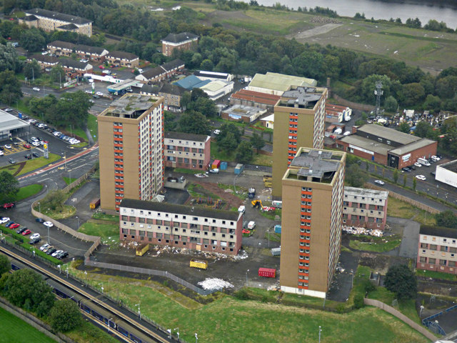
Yoker towerblocks from the air
Introduction
The photograph on this page of Yoker towerblocks from the air by Thomas Nugent as part of the Geograph project.
The Geograph project started in 2005 with the aim of publishing, organising and preserving representative images for every square kilometre of Great Britain, Ireland and the Isle of Man.
There are currently over 7.5m images from over 14,400 individuals and you can help contribute to the project by visiting https://www.geograph.org.uk

Image: © Thomas Nugent Taken: 6 Sep 2019
Known as Clydebank East, the towerblocks are, from left to right, Howcraigs Court, Newshot Court and Edmonstone Court. Each block contains 110 apartments. Occupation rates were around 50% in 2015, at which time it was decided by West Dunbartonshire Council that the entire estate should be demolished. The last residents moved out in September 2018 and demolition began shortly afterwards. Yoker railway station is in the lower left corner, the River Clyde is in the background.

