Red Poppy Restaurant, Strathpeffer
Introduction
The photograph on this page of Red Poppy Restaurant, Strathpeffer by Richard Dorrell as part of the Geograph project.
The Geograph project started in 2005 with the aim of publishing, organising and preserving representative images for every square kilometre of Great Britain, Ireland and the Isle of Man.

There are currently over 7.5m images from over 14,400 individuals and you can help contribute to the project by visiting https://www.geograph.org.uk
Red Poppy Restaurant, Strathpeffer
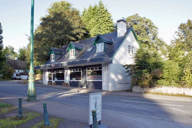
Image: © Richard Dorrell Taken: 8 Sep 2019
This building, though now only one property, and trading as a restaurant, was originally four separate premises. It is present on the OS 2nd edition map (1906), though the current footprint is much larger. The stone footings are original, though the roof burnt down c. 1960 and the then three shops were converted into two. In the early 2000s, the property still had 3 post codes.
Images are licensed for reuse under creativecommons.org/licenses/by-sa/2.0
Image Location


Leaflet Map data © OpenStreetMap
Latitude
57.58729
Longitude
-4.538744