A silenced bell
Introduction
The photograph on this page of A silenced bell by Neil Owen as part of the Geograph project.
The Geograph project started in 2005 with the aim of publishing, organising and preserving representative images for every square kilometre of Great Britain, Ireland and the Isle of Man.

There are currently over 7.5m images from over 14,400 individuals and you can help contribute to the project by visiting https://www.geograph.org.uk
A silenced bell
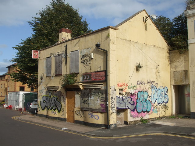
Image: © Neil Owen Taken: 4 Sep 2019
The Bell is closed. This particular pub has a long history, dating back to the late eighteenth century but has now served its last pint. It lies in what was a very industrial area back in the day, with glassworks, sail-cloth factories, flax and twine works, a brewhouse among it neighbours, along with later arrivals such as the railways. But the Bell stands on the site of a forge, so perhaps this is what gave it its name. The pub (once called the Blue Bell for a while) relied largely on trade from the surrounding industries, rather than residential drinkers. However, the area has undergone a pretty far-ranging redevelopment in recent years, with trade falling in line with much of the pub trade. It closed a few years ago, remained derelict and subject to a fire. Plans are being approved for its demolition and the building of housing, despite local calls for it to be retained as a vital part of the local heritage.
Images are licensed for reuse under creativecommons.org/licenses/by-sa/2.0
Image Location


Leaflet Map data © OpenStreetMap
Latitude
51.447584
Longitude
-2.587339