All Saints Church, Aston
Introduction
The photograph on this page of All Saints Church, Aston by Neil Theasby as part of the Geograph project.
The Geograph project started in 2005 with the aim of publishing, organising and preserving representative images for every square kilometre of Great Britain, Ireland and the Isle of Man.

There are currently over 7.5m images from over 14,400 individuals and you can help contribute to the project by visiting https://www.geograph.org.uk
All Saints Church, Aston
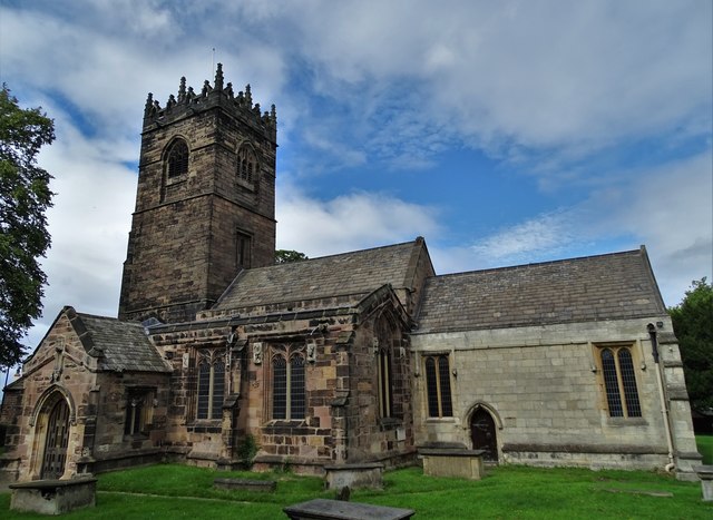
Image: © Neil Theasby Taken: 3 Sep 2019
The main body of the church is a Grade I listed building that dates back to the 12th century. All Saints was extensively remodelled in the late 14th and 15th centuries, and the chancel was rebuilt in the 19th century.
Images are licensed for reuse under creativecommons.org/licenses/by-sa/2.0
Image Location


Leaflet Map data © OpenStreetMap
Latitude
53.362059
Longitude
-1.298073