Operations room, Raigmore Emergency Bunker
Introduction
The photograph on this page of Operations room, Raigmore Emergency Bunker by Craig Wallace as part of the Geograph project.
The Geograph project started in 2005 with the aim of publishing, organising and preserving representative images for every square kilometre of Great Britain, Ireland and the Isle of Man.

There are currently over 7.5m images from over 14,400 individuals and you can help contribute to the project by visiting https://www.geograph.org.uk
Operations room, Raigmore Emergency Bunker
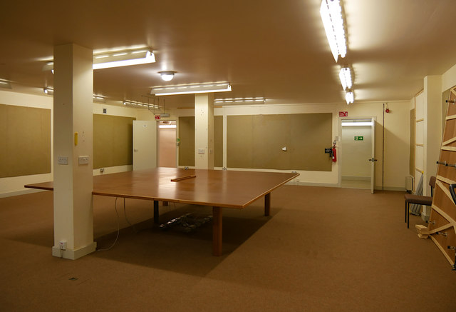
Image: © Craig Wallace Taken: 31 Aug 2019
The main room in the centre of the bunker. When built in World War II as a Radar processing block, this was the Filter Room, known as the 'pit'. It had a large map on a plotting table. Plotters would receive and process data from Radar, then mark the aircraft positions on the map. This room originally spanned both floors in the bunker, with a balcony above. The floor above was built during renovations in the 1980s. During later use as the Highland Council Emergency Centre, this was the main meeting room. Any major incident could be coordinated from here.
Images are licensed for reuse under creativecommons.org/licenses/by-sa/2.0
Image Location
Latitude
57.481349
Longitude
-4.198895