Battersea railway lines from the air
Introduction
The photograph on this page of Battersea railway lines from the air by Thomas Nugent as part of the Geograph project.
The Geograph project started in 2005 with the aim of publishing, organising and preserving representative images for every square kilometre of Great Britain, Ireland and the Isle of Man.

There are currently over 7.5m images from over 14,400 individuals and you can help contribute to the project by visiting https://www.geograph.org.uk
Battersea railway lines from the air
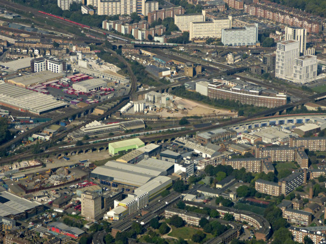
Image: © Thomas Nugent Taken: 26 Aug 2019
A web of lines and junctions south of the former power station. Battersea bus depot and the Gatwick Express railway maintenance depot are on the left. Part of Carey Gardens housing estate can be seen in the foreground. This 1970s development by architect Nick Wood provides high density housing in a low rise format.
Images are licensed for reuse under creativecommons.org/licenses/by-sa/2.0
Image Location


Leaflet Map data © OpenStreetMap
Latitude
51.473829
Longitude
-0.137365