High Street, Canterbury
Introduction
The photograph on this page of High Street, Canterbury by John Baker as part of the Geograph project.
The Geograph project started in 2005 with the aim of publishing, organising and preserving representative images for every square kilometre of Great Britain, Ireland and the Isle of Man.

There are currently over 7.5m images from over 14,400 individuals and you can help contribute to the project by visiting https://www.geograph.org.uk
High Street, Canterbury
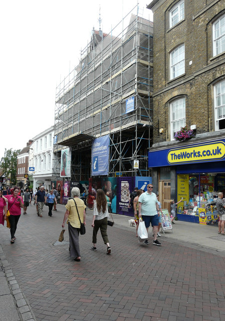
Image: © John Baker Taken: 4 Aug 2019
The building with its frontage encased in scaffolding. is the Beaney House of Art and Knowledge, which is the central museum, library and art gallery. It is housed in a grade II listed building. Until it closed for refurbishment in 2009, it was known as the Beaney Institute or the Royal Museum and Art Gallery. It reopened under its new name in September 2012. The building, museum and art gallery are owned and managed by Canterbury City Council; Kent County Council is the library authority. These authorities work in partnership with stakeholders and funders https://en.wikipedia.org/wiki/Beaney_House_of_Art_and_Knowledge
Images are licensed for reuse under creativecommons.org/licenses/by-sa/2.0
Image Location
Latitude
51.279064
Longitude
1.079946