Church Road, Plympton St Maurice, Devonshire
Introduction
The photograph on this page of Church Road, Plympton St Maurice, Devonshire by David Hallam-Jones as part of the Geograph project.
The Geograph project started in 2005 with the aim of publishing, organising and preserving representative images for every square kilometre of Great Britain, Ireland and the Isle of Man.

There are currently over 7.5m images from over 14,400 individuals and you can help contribute to the project by visiting https://www.geograph.org.uk
Church Road, Plympton St Maurice, Devonshire
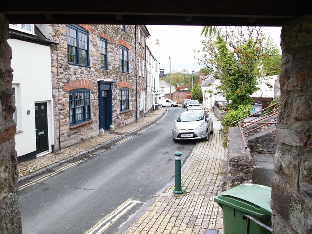
Image: © David Hallam-Jones Taken: 29 Aug 2019
A view from the Parish Church's lychgate. The suspended pub sign on the building in the distance is that of the C16th "London Inn". Opposite the inn is the town's former Salvation Army Citadel, currently "For Sale".
Images are licensed for reuse under creativecommons.org/licenses/by-sa/2.0
Image Location


Leaflet Map data © OpenStreetMap
Latitude
50.383428
Longitude
-4.047074