View along Stone Row
Introduction
The photograph on this page of View along Stone Row by Robert Graham as part of the Geograph project.
The Geograph project started in 2005 with the aim of publishing, organising and preserving representative images for every square kilometre of Great Britain, Ireland and the Isle of Man.

There are currently over 7.5m images from over 14,400 individuals and you can help contribute to the project by visiting https://www.geograph.org.uk
View along Stone Row
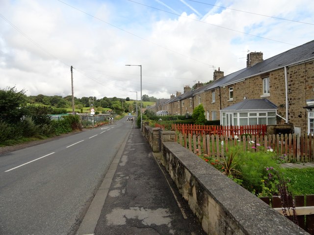
Image: © Robert Graham Taken: 12 Aug 2019
This street forms the western edge of the ex-mining village of Grange Villa. It is also the original street in the village, dating from the late C19. As the name states, these are stone built miners cottages. The rest of the village, dating from the Edwardian era at the start of the C20, is brick built. This terrace is notable for all the tidy front gardens too.
Images are licensed for reuse under creativecommons.org/licenses/by-sa/2.0
Image Location
Latitude
54.863059
Longitude
-1.639621