Tanglandford Bridge
Introduction
The photograph on this page of Tanglandford Bridge by Mary and Angus Hogg as part of the Geograph project.
The Geograph project started in 2005 with the aim of publishing, organising and preserving representative images for every square kilometre of Great Britain, Ireland and the Isle of Man.

There are currently over 7.5m images from over 14,400 individuals and you can help contribute to the project by visiting https://www.geograph.org.uk
Tanglandford Bridge
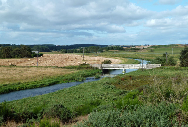
Image: © Mary and Angus Hogg Taken: 22 Aug 2019
According to the OS maps, this is Tangland Bridge but the plaque on the structure gives the name Tanglandford, with the bridge constructed in 1864. The bridge crosses the River Ythan downstream from Methlick.
Images are licensed for reuse under creativecommons.org/licenses/by-sa/2.0
Image Location


Leaflet Map data © OpenStreetMap
Latitude
57.414953
Longitude
-2.188592