
Crowdy Mill
Introduction
The photograph on this page of Crowdy Mill by Derek Harper as part of the Geograph project.
The Geograph project started in 2005 with the aim of publishing, organising and preserving representative images for every square kilometre of Great Britain, Ireland and the Isle of Man.

There are currently over 7.5m images from over 14,400 individuals and you can help contribute to the project by visiting https://www.geograph.org.uk
Crowdy Mill
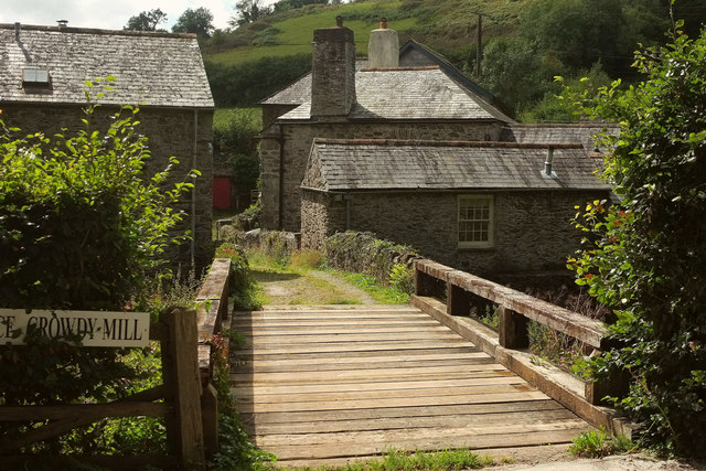
Image: © Derek Harper Taken: 29 Aug 2019
There are five listed structures here, and this update on Image gives an opportunity to provide links to the descriptions. In the foreground is an early C19 bridge https://historicengland.org.uk/listing/the-list/list-entry/1215984 over the Harbourne River. The single-storey building across it was "Originally probably a pigsty" https://historicengland.org.uk/listing/the-list/list-entry/1287449 . Behind is the mill and mill house https://historicengland.org.uk/listing/the-list/list-entry/1215944 : "Restored to working order 1982-4". Behind the mill house is a listed outbuilding. On the left is what was probably a barn or cart shed, listed as "Tailrace" https://historicengland.org.uk/listing/the-list/list-entry/1108233 , but mapped as Crowdy Mill Cottage.
Images are licensed for reuse under creativecommons.org/licenses/by-sa/2.0
Image Location

Latitude
50.391396
Longitude
-3.703572