The Blue Stane, Crail
Introduction
The photograph on this page of The Blue Stane, Crail by Andrew Curtis as part of the Geograph project.
The Geograph project started in 2005 with the aim of publishing, organising and preserving representative images for every square kilometre of Great Britain, Ireland and the Isle of Man.

There are currently over 7.5m images from over 14,400 individuals and you can help contribute to the project by visiting https://www.geograph.org.uk
The Blue Stane, Crail
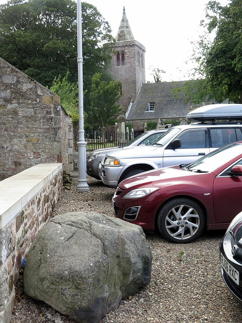
Image: © Andrew Curtis Taken: 22 Aug 2019
Outside the church gates lies a large boulder called the Blue Stane. This is traditionally said to have been thrown by the devil from the Isle of May when the church was being built. The stone split in mid-air, one piece landing here and the other, larger piece, landing on Balcomie Beach near Fife Ness Image A circular depression on the surface of the stone is said to be the mark of the devil's thumb. Similar stones are considered by geologists to be merely erratics delivered by past glaciers. The Church was built around the mid 12th century and was consecrated by Bishop De Bernham of St Andrews in 1243. Originally the Church was dedicated to St Maolrubh of Applecross (Rufus the Redhead) but later changed to St Mary when Celtic saints fell out of favour with the Roman Church.
Images are licensed for reuse under creativecommons.org/licenses/by-sa/2.0
Image Location
Latitude
56.262196
Longitude
-2.625035