Route finding in SO 1000
Introduction
The photograph on this page of Route finding in SO 1000 by Graham Horn as part of the Geograph project.
The Geograph project started in 2005 with the aim of publishing, organising and preserving representative images for every square kilometre of Great Britain, Ireland and the Isle of Man.

There are currently over 7.5m images from over 14,400 individuals and you can help contribute to the project by visiting https://www.geograph.org.uk
Route finding in SO 1000
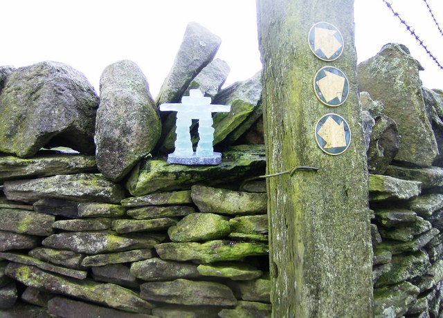
Image: © Graham Horn Taken: 1 Dec 2007
This is a close up of Inukshuk, an ice or stone figure used by Inuit to guide the way. This does not normally belong here, although it is appropriate for a footpath junction. I placed it as part of the celebration of 1000 days of Geograph. See also Image]
Images are licensed for reuse under creativecommons.org/licenses/by-sa/2.0
Image Location
Latitude
51.700112
Longitude
-3.290088