Route finding in SO 1000
Introduction
The photograph on this page of Route finding in SO 1000 by Graham Horn as part of the Geograph project.
The Geograph project started in 2005 with the aim of publishing, organising and preserving representative images for every square kilometre of Great Britain, Ireland and the Isle of Man.

There are currently over 7.5m images from over 14,400 individuals and you can help contribute to the project by visiting https://www.geograph.org.uk
Route finding in SO 1000
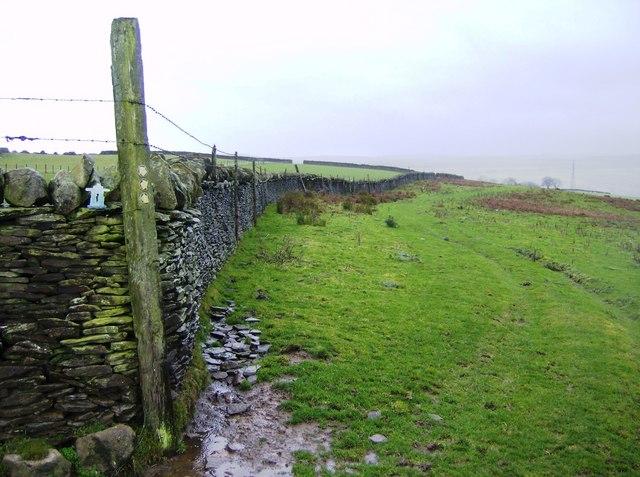
Image: © Graham Horn Taken: 1 Dec 2007
This is near the junction of a number of paths. This view looks west and the path contours round this hill with a steep drop always to the right. The picture also celebrates the first 1000 days of Geograph by featuring an Inukshuk, the nickname of Gary Rogers the site's founder. Inukshuk is Inuit meaning "friend and guide" and consists of small stones, built in the shape of a man, placed at junctions to indicate the way. The weather was appropriately Arctic as well.
Images are licensed for reuse under creativecommons.org/licenses/by-sa/2.0
Image Location


Leaflet Map data © OpenStreetMap
Latitude
51.698916
Longitude
-3.292514