Cannon from the Canteloupe, Thurlestone
Introduction
The photograph on this page of Cannon from the Canteloupe, Thurlestone by Stephen McKay as part of the Geograph project.
The Geograph project started in 2005 with the aim of publishing, organising and preserving representative images for every square kilometre of Great Britain, Ireland and the Isle of Man.

There are currently over 7.5m images from over 14,400 individuals and you can help contribute to the project by visiting https://www.geograph.org.uk
Cannon from the Canteloupe, Thurlestone
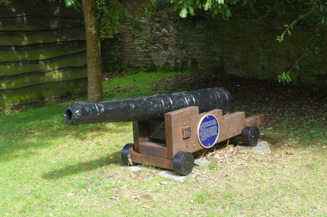
Image: © Stephen McKay Taken: 17 Aug 2019
This old cannon stands on Thurlestone's village street immediately opposite the post office. According to the blue plaque it was raised from a 300 ton barque, the Canteloupe, which was wrecked on Thurlestone Rock in 1772. She was on her way home from Grenada to London with a cargo of sugar, coffee and rum; 13 crew and seven passengers were aboard, only one of whom survived - the rest are buried in Thurlestone churchyard. At the time the infamous slave trade triangle would have been in operation, the last leg of which brought goods from the American and Caribbean colonies to Britain, although there appears to be no specific evidence that the Canteloupe was involved.
Images are licensed for reuse under creativecommons.org/licenses/by-sa/2.0
Image Location
Latitude
50.270691
Longitude
-3.862185