Rossie Island shoreline showing a division of surfaces
Introduction
The photograph on this page of Rossie Island shoreline showing a division of surfaces by Andrew Diack as part of the Geograph project.
The Geograph project started in 2005 with the aim of publishing, organising and preserving representative images for every square kilometre of Great Britain, Ireland and the Isle of Man.

There are currently over 7.5m images from over 14,400 individuals and you can help contribute to the project by visiting https://www.geograph.org.uk
Rossie Island shoreline showing a division of surfaces
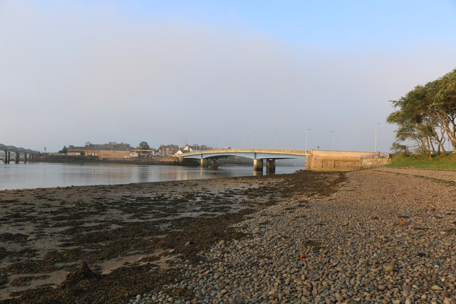
Image: © Andrew Diack Taken: 29 Jul 2019
This photo shows that the inner shoreline nearer the tidal flow of the River South Esk is composed of mud with seaweed growing on top whereas that part further from the water is a beach of pebbles.
Images are licensed for reuse under creativecommons.org/licenses/by-sa/2.0
Image Location
Latitude
56.704963
Longitude
-2.476876