Pelton Grange farm
Introduction
The photograph on this page of Pelton Grange farm by Robert Graham as part of the Geograph project.
The Geograph project started in 2005 with the aim of publishing, organising and preserving representative images for every square kilometre of Great Britain, Ireland and the Isle of Man.

There are currently over 7.5m images from over 14,400 individuals and you can help contribute to the project by visiting https://www.geograph.org.uk
Pelton Grange farm
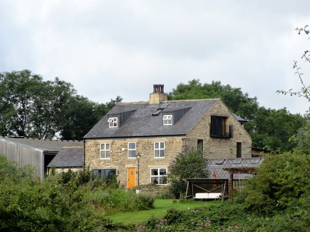
Image: © Robert Graham Taken: 12 Aug 2019
This farm stands north of Pelton Lane, at the east side of Grange Villa. The farm gave its name to the ex mining village of Grange Villa, which was founded in the late C19 to house miners working at Handen Hold Colliery. The farm is shown on the 1861 First Series Ordnance Survey map. The layout on the map suggests an early Victorian planned courtyard farmstead, but I don't know its exact history. The farmhouse shown here seems to show quite a lot of modernisation.
Images are licensed for reuse under creativecommons.org/licenses/by-sa/2.0
Image Location
Latitude
54.863491
Longitude
-1.633853